


Voting District 111, Harrison County, Mississippi
About
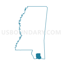
Outline

Summary
| Unique Area Identifier | 605494 |
| Name | Voting District 111 |
| County | Harrison County |
| State | Mississippi |
| Area (square miles) | 17.30 |
| Land Area (square miles) | 16.62 |
| Water Area (square miles) | 0.68 |
| % of Land Area | 96.09 |
| % of Water Area | 3.91 |
| Latitude of the Internal Point | 30.48638380 |
| Longtitude of the Internal Point | -88.92106800 |
Maps


Graphs
Select a template below for downloading or customizing gragh for Voting District 111, Harrison County, Mississippi


Neighbors
Neighoring Voting District (by Name) Neighboring Voting District on the Map
- Voting District 109, Harrison County, MS
- Voting District 112, Harrison County, MS
- Voting District 114, Harrison County, MS
- Voting District 506, Harrison County, MS
- Voting District 508, Harrison County, MS
- Voting District 509, Harrison County, MS
- Latimer Voting District, Jackson County, MS
- St. Martin Voting District, Jackson County, MS
Top 10 Neighboring County Subdivision (by Population) Neighboring County Subdivision on the Map
- District 5, Harrison County, MS (42,436)
- District 1, Harrison County, MS (31,234)
- District 4, Jackson County, MS (30,708)
Top 10 Neighboring Place (by Population) Neighboring Place on the Map
- Biloxi city, MS (44,054)
- D'Iberville city, MS (9,486)
- St. Martin CDP, MS (7,730)
- Latimer CDP, MS (6,079)
Top 10 Neighboring Unified School District (by Population) Neighboring Unified School District on the Map
- Harrison County School District, MS (86,048)
- Jackson County School District, MS (49,652)
- Biloxi Public School District, MS (38,219)
Top 10 Neighboring State Legislative District Lower Chamber (by Population) Neighboring State Legislative District Lower Chamber on the Map
- State House District 116, MS (29,749)
- State House District 114, MS (29,403)
- State House District 115, MS (13,505)
Top 10 Neighboring State Legislative District Upper Chamber (by Population) Neighboring State Legislative District Upper Chamber on the Map
- State Senate District 51, MS (62,901)
- State Senate District 49, MS (59,022)
- State Senate District 50, MS (51,017)
Top 10 Neighboring 111th Congressional District (by Population) Neighboring 111th Congressional District on the Map
Top 10 Neighboring Census Tract (by Population) Neighboring Census Tract on the Map
- Census Tract 34.02, Harrison County, MS (10,156)
- Census Tract 33.01, Harrison County, MS (8,418)
- Census Tract 403, Jackson County, MS (7,730)
- Census Tract 402.04, Jackson County, MS (6,602)
- Census Tract 33.03, Harrison County, MS (6,307)
- Census Tract 39, Harrison County, MS (3,278)
- Census Tract 9, Harrison County, MS (2,927)